HOW DIFFICULT IS GANGOTRI TREK
The Gangotri trek presents a moderately challenging adventure, subject to multiple factors such as weather condition, fitness, and altitude acclimatization. The trek is usually over 6 days starting from Rishikesh. Permit is required from the forest officials.
The base of the trek starts from Gangotri at an altitude of 3100 meters (10,200 feet), trekkers cover 15 kilometers covering some distance each day in camps, to reach Bhojbasa, a typical camping spot.
The trail toughens as it passes through forests and streams towards the Gaumukh Glacier for another 5 kms. The snout of the glacier is known as Gaumukh – the source of the holy river Ganges in hindu mythology.
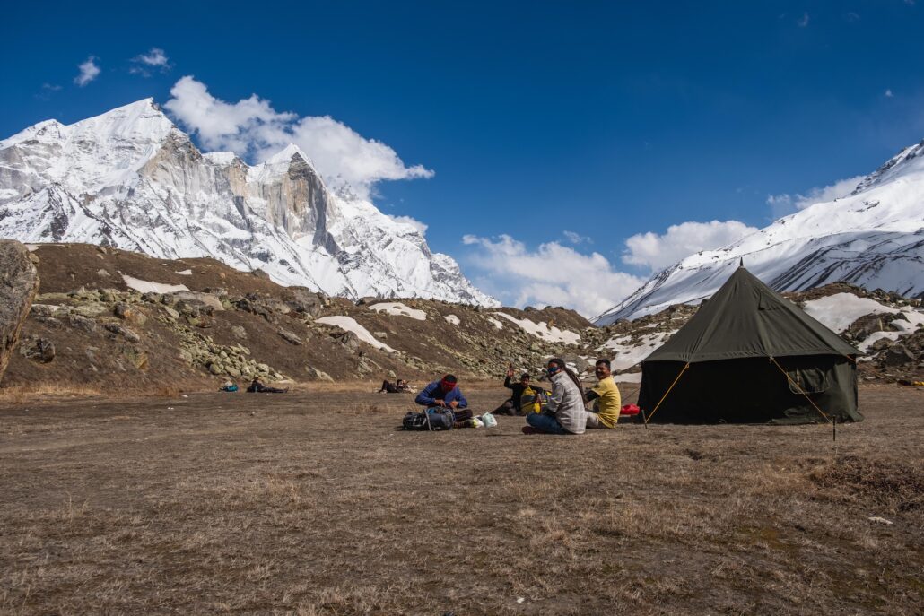
One has to walk on rocky terrain climbing through rocks and boulders and crossing glacial streams, trekkers further hike to Tapovan, which is a steep climb of approximately 4 kms. Its a high altitude (4400 meters ) meadow at the foothills of Mt Shivling, for an ultimate scenic and spritual experience.
High point for Gangotri Gaumukh trek is reaching Tapovan, which is also home to Sadhus(indian sage). It also serves as the base camp for mountaineers for expedition to Auden Cole trek, Kedarnath etc.
Though no technical climbing is required, altitude, steep sections, and weather fluctuations pose challenges. Preparation reuires prior physical fitness, gradual acclimatization, and packing essentials like warm clothing and sturdy footwear. Also gears to climb and combat snow incase of snowfall is required.
While achievable for moderately fit individuals with some trekking experience and fitness, caution guidance and adequate preparation from experienced guides or trekking agencies is warranted to ensure a safe and enjoyable trekking experience in the mesmerizing landscapes of Gangotri and beyond.
At Mapping the Himalayas, we ensure safety of the clients and provide all gears. Permits will also be arranged by us.
