Gangotri Gaumukh Tapovan Trek
Overview
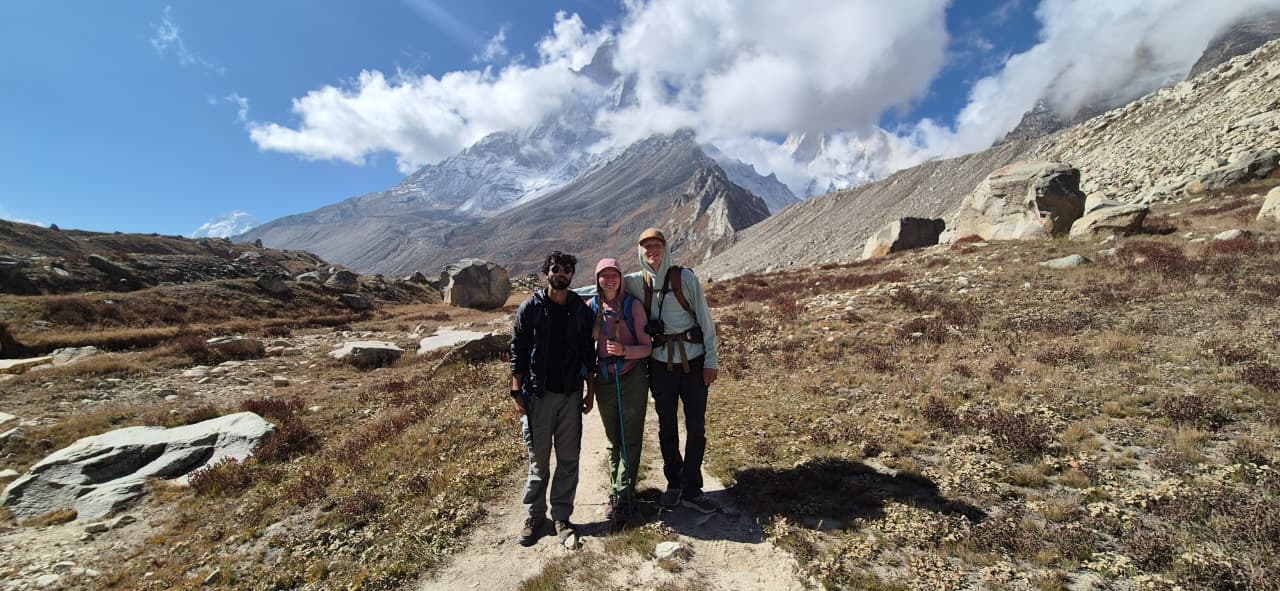
The Gangotri Gaumukh Tapovan Trek, also known as the Source of the Ganges, is an amazing trek situated at 14,640 ft above sea level in the Gangotri National park in the Garhwal Himalayas. It is a place where both people who love adventure and those on a religious journey go.
The name “Gaumukh” comes from the famous Gaumukh glacier, which is where the holy Ganges River begins.
The Gangotri trek is 48 km long trek which can be done in 6 days from Rishikesh to Rishikesh. The Gaumukh Tapovan trek is famous for its beautiful landscapes, like the Bhagirathi peaks, Mt. Shivalinga, and many other famous peaks. You will see lush meadows in Tapovan and rocky areas with big boulders.
Gaumukh Tapovan trek also lets you feel connected to the spiritual importance of the Ganges River. Pilgrims come here to take holy water and a dip to seek blessings, and people who love adventure are excited by the natural beauty and challenges the gangotri gomukh tapovan trek offers. This route has been used for a very long time by spiritual seekers and is a dream come true for nature lovers.
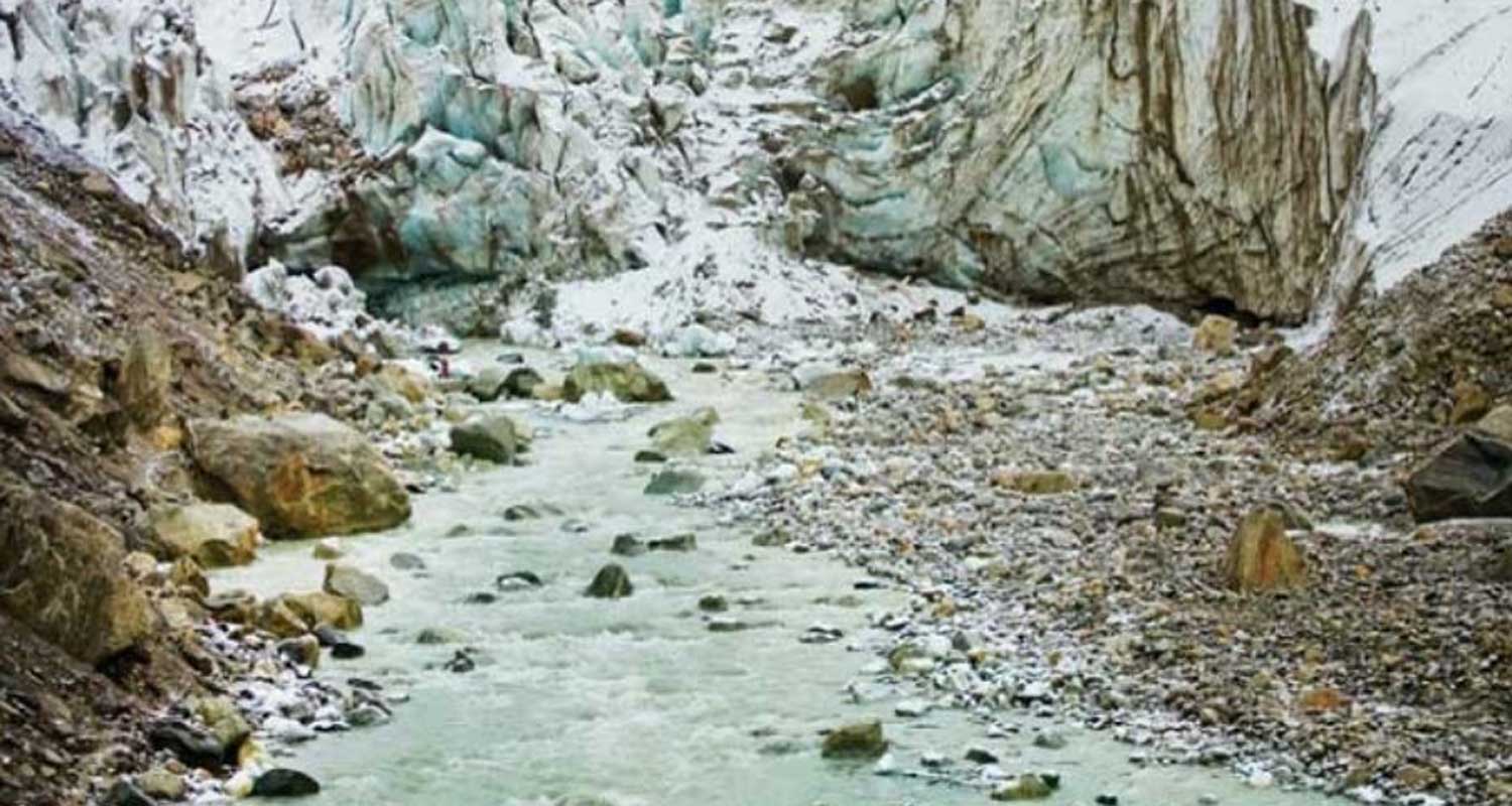
During the Gangotri Gaumukh Tapovan trek, we will explore the special place called “Zero point” at Gaumukh s
Brief Itinerary
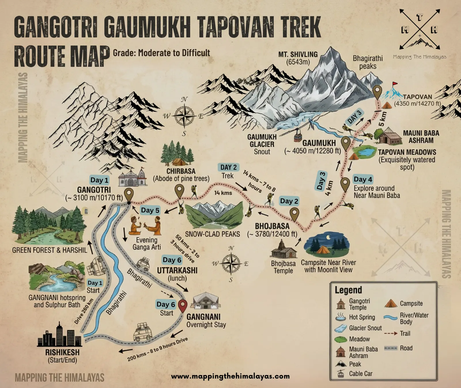
Day 1: Drive from Rishikesh to Gangotri (~ 3100 m/10170 ft) – 260 kms – 10 to 11 hours drive
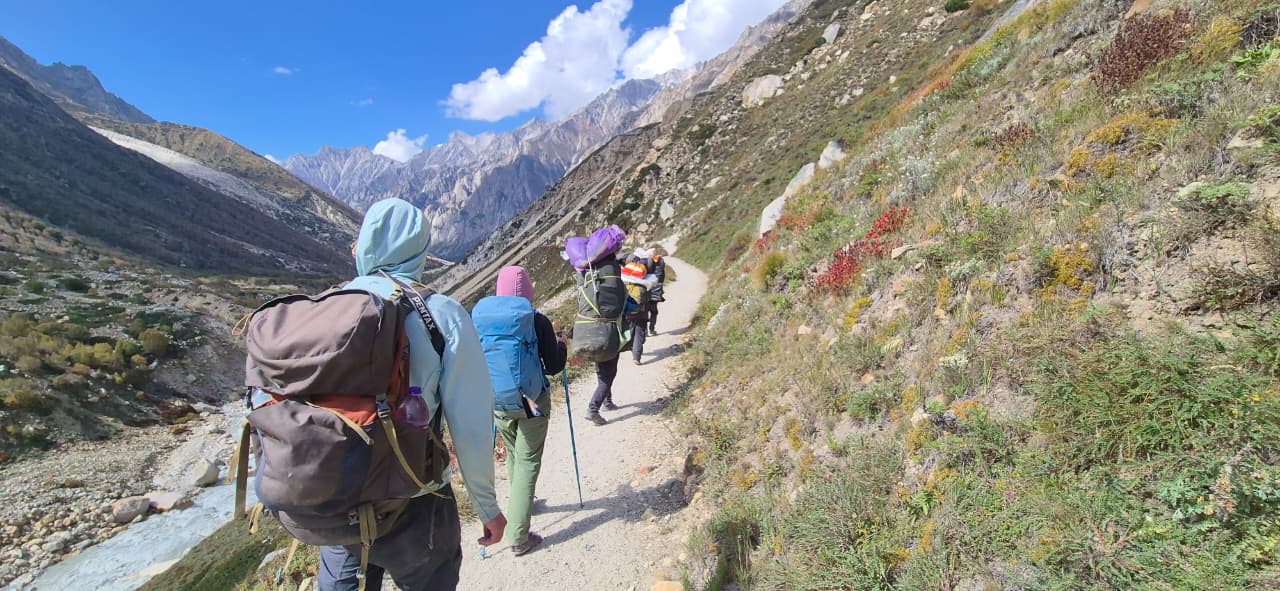
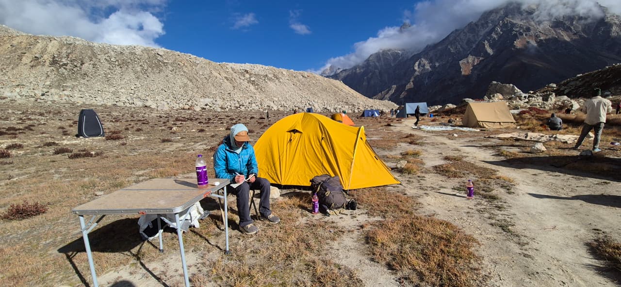
Day 2: Trek to Bhojbasa (~ 3780/12400 ft)– 14 kms – 7 to 8 hours. Camp for the night
Day 3: Trek to Gaumukh (~ 4050 m/12280 ft) is 4 Kms – trek from Gaumukh to Tapovan (~4350 m/14270 ft) around 5 Kms and to camping ground Near Mauni Baba Ashram – 7 to 8 hours walk. Camp for the night
Day 4: Early morning explore Tapovan meadows and around. After breakfast descent to Bhojbasa – 6 to 7 hours. Camp for the night
Day 5: Trek back to Gangotri – 14 kms – 6 to 7 hours , drive from Gangotri to Gangnani – 50 kms – 2 to 3 hours drive, overnight stay at gangnani
Day 6: Trek concludes, drive back to Rishikesh – 200 kms – 8 to 9 hours Drive
Trek Cost : Rs. 30,000/- Per Person
Number of Days: 06 Days
Gangotri to Gaumukh Trek distance : 18 kms
Category : Moderate to Difficult Adventure
Area: Gharwal Himalayas, Uttarakhand, India
Highlights: Gangotri Temple, Gangnani hotspring, Glacial origin, majestic peaks, serene meadows, spiritual journey, panoramic vistas
Highest point:4463 m
Gaumukh Tapovan Trek best time: May to June & Sept till Nov
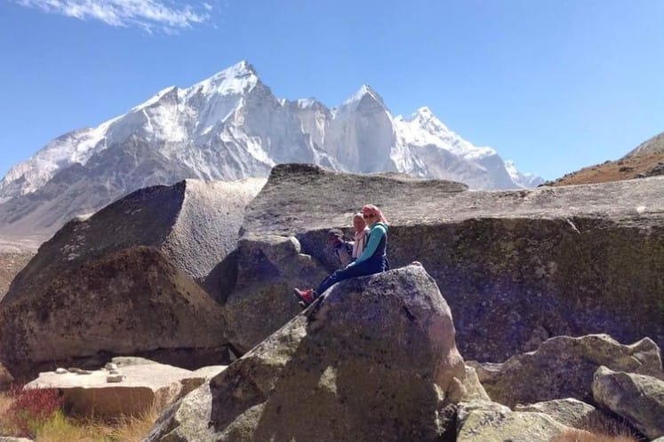
Tapovan Meadow
Detailed Itinerary – Gangotri Gaumukh Tapovan Trek
Day 1: Drive from Rishikesh to Gangotri (~ 3100 m/10170 ft) – 260 kms – 10 to 11 hours drive
Our journey begins at 6:30 AM. Then we drive to Gangotri along the river bank of river Ganga (Bhagirathi) and in the mid-way visit Hot spring and take a sulphur bath in Gangnani. On the way to our base camp, we will see the beautiful view of the Greater Himalayas, Harshil and green forest.
On arrival check in the homestay/ hotel in the evening as we visit the holy city Gangotri. By 7 pm we will see a nice Ceremony (Arti) of Goddess GANGA. Dinner and overnight stay.
Day 2: Trek to Bhojbasa (~ 3780/12400 ft)– 14 kms – 7 to 8 hours. Camp for the night.
Morning, you fill yourself with food needed for the trek to Bhojbasa that will take about 8 hours to cover. The scenery is just magnificent, and you cannot stop to admire the beauty of the forests and the valleys down below, especially Chirbasa or the abode of pine trees. The entire trek today is along the roaring Bhagirathi River.
Trek above the Bhagirathi River is on a relatively groomed path to Chirbasa.
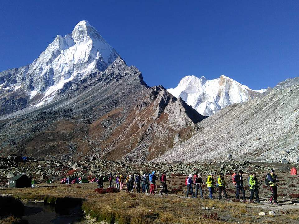
Above Chirbasa, the valley widens and offers views of snow-clad peaks in the south. It is a gentle walk to Bhojbasa (3,780m). Running virtually due south-east along the river, the Bhagirathi peaks over a beacon to the source of the river.
Bhojbasa is the widest point in the upper valley, and camping here at night offers magnificent moonlit views of the Bhagirathi peaks. The trek further to Bhojbasa is along the path that slowly flattens out and dips suddenly to reveal Bhojbasa with a small temple and a potential campsite near the river. The camp is set up near the river.
Dinner and overnight stay in tents. Enjoy incredible scenery and sight of Bhagirathi and ShivLing Mountain, dinner and rest under the tent.
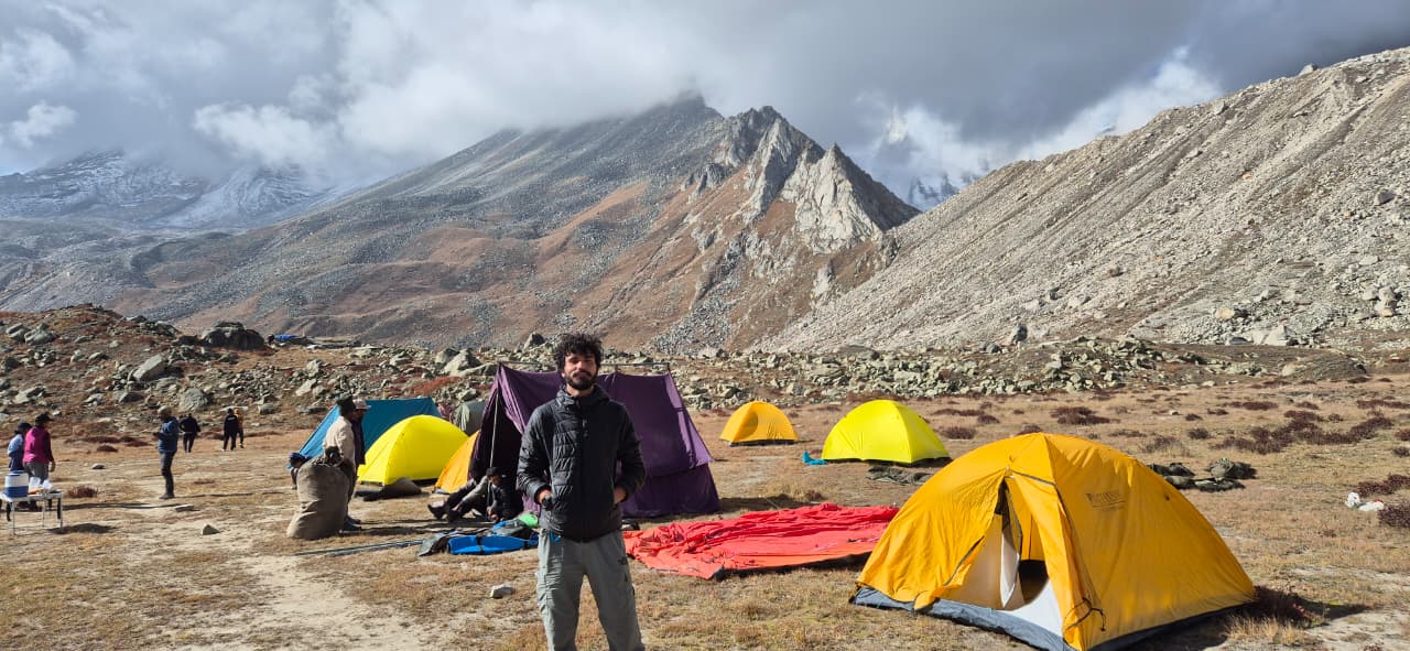
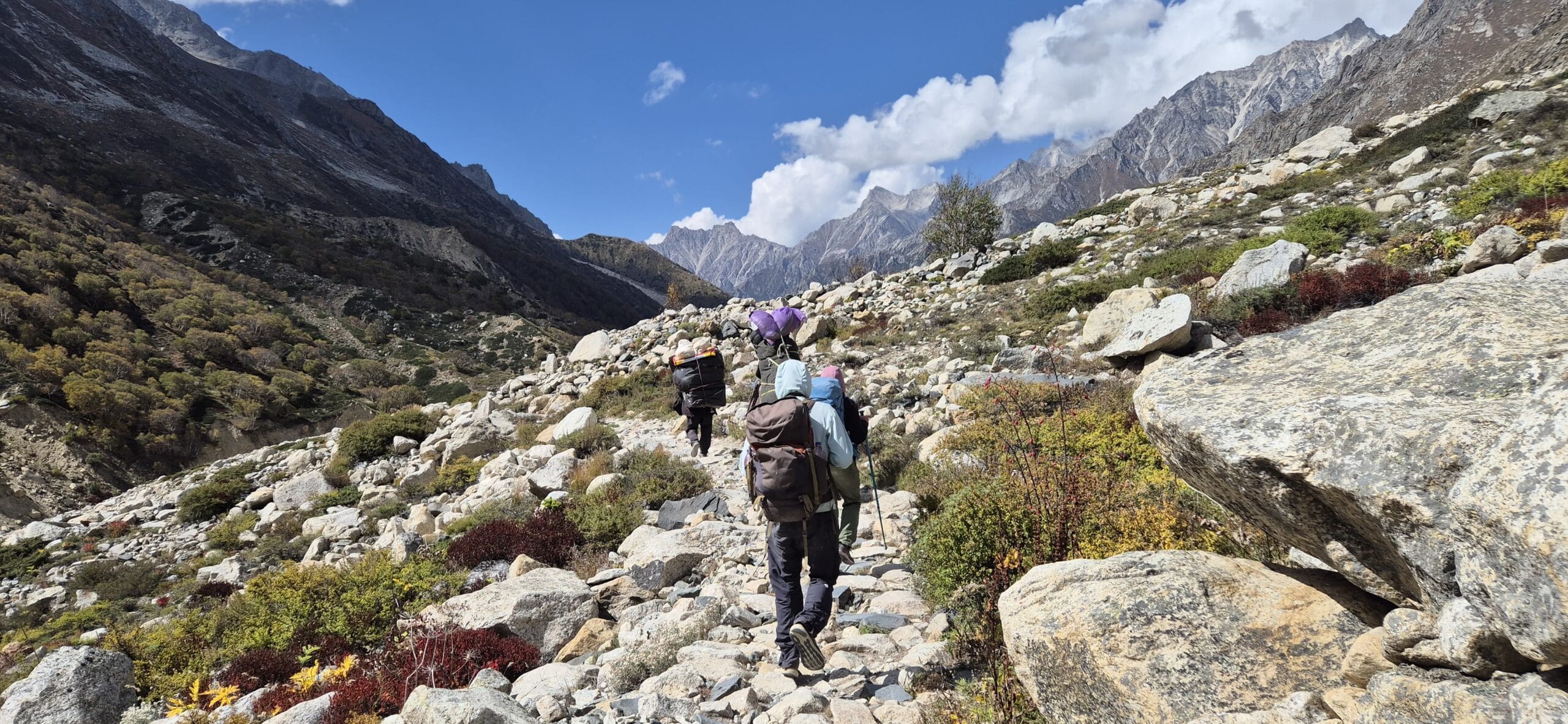
Day 3: Trek to Gaumukh (~ 4050 m/12280 ft) is 4 Kms – trek from Gaumukh to Tapovan (~4350 m/14270 ft) around 5 Kms and to camping ground Near Mauni Baba Ashram – 7 to 8 hours walk. Camp for the night
We will cross the river with a manual cable car first. The first four kilometres upstream from Bhojbasa are surprising though the narrow valley. The path runs smoothly above the river and is fringed by a grassy meadow.
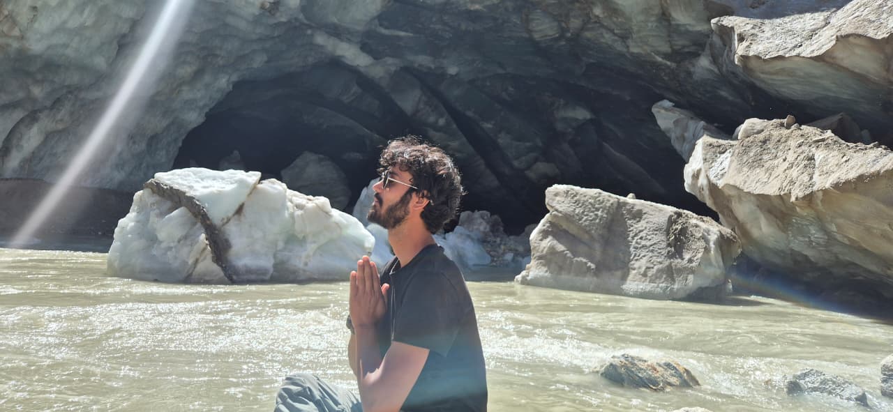
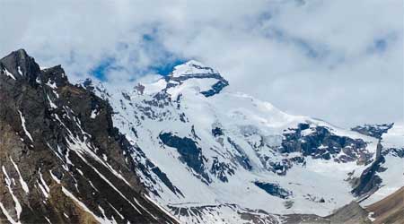
With about a kilometer to go, the terrain turns rocky, and one has to pick one’s way through the rocks and boulders, down to a sandy beach sheltered by enormous piles of granite. Incidentally, the beach is an excellent place to camp. Scour the water’s edge for shards of ice, or follow the broken path along the river’s edge to the very foot of Gaumukh (3,969m), and look up at the Shivling Peak (6543m) almost vertically above.
Once you have reached the southern (left) bank of the river valley, the path is marked with a steep climb of nearly a thousand feet to the meadows at the base of Shivling Peak. This is Tapovan, an exquisitely watered spot from which the fabled peak of Shivling appears to sweep up in a wave of screen, granite, and snow. It is an idyllic camping spot; alternatively, a couple of Babas have establishments.
Day 4: Early morning explore Tapovan meadows and around. After breakfast descent to Bhojbasa – 6 to 7 hours. Camp for the night
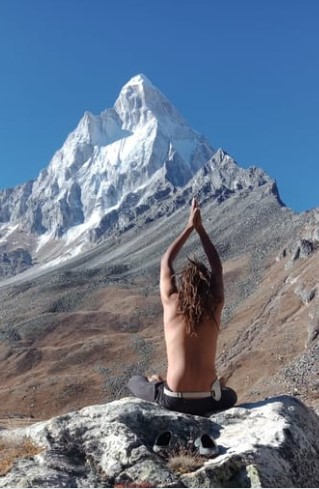
Tapovan is a high-altitude alpine meadow below Mt. Shivling, which dominates the landscape. Tapovan is over 2 km in length. The area close to Mt. Shivling is wet during early summer due to melting snow and glacial water.
These grounds have been used by many sages to meditate over the centuries. Descent down to Bhojbasa through Zero point at Gaumukh, The Source of the Ganges.
Day 5: Trek back to Gangotri – 14 kms – 6 to 7 hours , drive from Gangotri to Gangnani – 50 kms – 2 to 3 hours drive, overnight stay
It’s time to trace the trail back. It’s downhill all the way till Gangotri, allowing time for a drive to Gangnani.
Day 6: Trek concludes, drive back to Rishikesh – 200 kms – 8 to 9 hours Drive
Our gangotri gaumukh tapovan trek concludes as we drive from tapovan from Gangnani to Uttarkashi at lunch and then drive to Rishikesh 200kms. At evening trip and services concludes with sweet memories.
Gangotri Gaumukh Tapovan Trek Map
Frequently Asked Questions (FAQS) About Gangotri Gaumukh Tapovan Trek
What is the Gangotri Gaumukh Tapovan Trek?
The Gaumukh Tapovan Trek is a trekking journey in the Himalayan Mountains of Uttarakhand in India. It is a trek along the Ganges River upto where it begins the journey to Gaumukh glacier.
Where is the Gangotri Gaumukh Tapovan Trek located?
This trek is located in the Gangotri national park in the Garhwal Himalayas of India.
Is there a permit required ?
The permit is obtained enroute from Uttarkashi. The Gaumukh Tapovan trek permit cost is included in the overall package cost, you do not have to pay anything extra.
What is the Gaumukh? It is called Gaumukh because there is a famous glacier here that looks like a cow’s mouth. In Sanskrit, “Gaumukh” means “cow’s mouth.” The source of the river Ganges originates from here.
What can I see during the trek?
You’ll see stunning landscapes with big mountains like Bhagirathi peaks and Mt. Shivalinga. There are also lush green meadows and rocky areas with broken rocks called moraine.
Is Gangotri and Gaumukh a holy place?
Yes, many people come here on a religious journey. They believe that the Ganges River is holy, and its source is at Gaumukh. Pilgrims seek blessings here.
Can anyone go on Gaumukh Tapovan trek?
While it is a bit challenging as it is graded as moderate adventure so anyone with good health and some trekking experience can go.
How long does the Gaumukh Tapovan trek take?
The trek usually takes about 6-8 days, depending on your starting point and pace.
What is Tapovan ?
Tapovan is a beautiful meadow. It is the base for Mt Shivalinga, situated at 14640 feet above sea level. where you can enjoy the serene surroundings. Tapovan is a place where many ancient sages meditated for years.
Read Latest Blogs
Valley of Flowers Trek Guide: My 6-Day Journey to Heaven with Mapping the Himalayas (Complete Itinerary, Cost, Tips & Honest Review)
Introduction Some trips become memories. Some become stories. And then there are a few journeys that change the way you
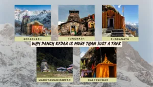
Why Panch Kedar is More Than Just a Trek
The Panch Kedar is a spiritual and adventure trip in Gharwal Himalayas. There’s five temples of lord Shiva in a
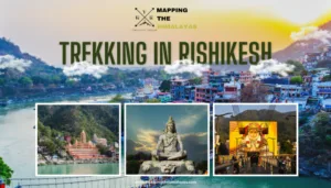
Trekking in Rishikesh – Best Treks and Short Hikes Near Rishikesh
Rishikesh is widely known as the Yoga Capital of the World, but it is also one of the best places
Delightful experiences of our clients - Reviews
Trustindex verifies that the original source of the review is Google. Enjoyed the sunrise view, the trekking from Kunjapuri temple in nature and sound of the birds 😊 Just it was crowded at the waterfall. I like somewhere peaceful. The guide is good and on time when he picked up me. That's the plus 😊Posted onTrustindex verifies that the original source of the review is Google. What an amazing experience! My partner and I booked the Chopta 4D3N trek. It was our first time in the mountains here in India. The entire trip was well organized and stress free. All of the gear we needed was provided. The camps and home stays were all great. The food was fantastic. We loved our guide, Ankush and his love for nature and the mountains. He kept everything running smoothly, took us on paths with almost no other people on them, made sure we always had our chai and shared many facts about the birds, plants and landscape along the way. Honorable mention for our driver, Sandeep. He kept us safe and always had a smile on his face. Highly recommend this company for any trek!Posted onTrustindex verifies that the original source of the review is Google. I came to India solo as a female traveler and left with memories that will stay with me for the rest of my life. From the moment the trip started, I felt completely safe, cared for, and genuinely looked after in a way that’s honestly rare to find anywhere in the world. We trekked Kedarnath, Badrinath, Tungnath, explored Mana village, stayed in beautiful homestays, crossed unbelievable mountain roads, and somehow every single day felt like an adventure movie mixed with a spiritual pilgrimage. The views were unreal. The photos we took look like scenes from a film. Every turn in the Himalayas felt surreal. What made this experience different though was the flexibility and heart behind it. Kalyan never treated the trip like a rigid itinerary. He gave me options constantly and built the experience around what I wanted to do, eat, explore, and experience. If I was hungry, we stopped. If I wanted chai, we found chai. If I wanted to stay longer somewhere beautiful, we stayed longer. I probably gained 7 kg because I was fed constantly and happily accepted my fate. At one point on the drive toward Tungnath, he randomly pulled out KitKats and handed them to me while we climbed higher into the mountains, and weirdly enough that tiny moment ended up becoming one of those memories that sticks with you forever. Kalyan also seemed to know everyone everywhere we went. Whether it was locals, guesthouses, shop owners, temple areas, drivers, or mountain routes, I genuinely felt like I only needed one contact in India to have a completely customized and authentic experience. He’s an incredible adventurer, an excellent businessman, and one of the most patient people I’ve met. But more than that, he’s deeply kind. I paid attention to the way he treated animals, children, older people, and strangers throughout the journey, and it told me everything I needed to know about his character. If you are a solo traveler, especially a woman, and you want an experience that feels safe, flexible, adventurous, personal, and unforgettable, book with Mapping the Himalayas. Some trips stay in your camera roll. This one stays somewhere much deeper.Posted onTrustindex verifies that the original source of the review is Google. Had a great experience with Mapping the Himalayas. I did the 4D3N Chotpa/Tungnath trek and it was one of the highlights of my India trip. Narayan, our guide, made the trip amazing. He is a sweet, funny guy with a gentle soul and it was super fun to hike with him. He is a local from Uttarkashi district and a devout Hindu, so he was able to give us lots of information about local culture, history, native plants and animals and of course Hinduism. He also knew things like the spots where we could watch the sunrise while avoiding the crowds. Would recommend him as a guide to anybody Thanks Narayan!Posted onTrustindex verifies that the original source of the review is Google. We had an amazing mountain trip called Chopta trek - everything was thoughtfully organised and we felt genuinely well taken care of throughout. The journey from Rishikesh took about 6–7 hours, but it passed quickly thanks to scenic stops at local restaurants, with meals already included in the price. Our guide, Narayan, was incredibly attentive, always checking that we were comfortable and had everything we needed. Even though I was a slower walker, he never rushed me and made sure I was always okay. I’d absolutely recommend this experience with them. They also provided all the essential gear, including hiking shoes and walking sticks, which made everything much easier.Posted onTrustindex verifies that the original source of the review is Google. I did the Chopta Chandrashila Tungnath trek with this company, and it was a really very memorable experience with our guide Ankush and driver Anil. Ankush is a very experienced guide for mountain treks. He is a local, so he explained everything in detail. I highly recommend this company.Posted onTrustindex verifies that the original source of the review is Google. My mother and I booked two experiences with them and had a fantastic time! We first went on the Kanjapuri Sunrise trek, where we got really lucky in the morning and were even able to see to the Himalaya! Before and during the trek there were enough breaks, we got some chai and were able to refresh ourselves in the pond of Neer Waterfall. The next day our Safari had to be postponed due to the park being closed due to rain. The guys were kind enough to still bring us to Hatidwar (where we were supposed to go afterwards) and picked us up from there the next morning! During the safari we were again accompanied by Ankush and had a fantastic time, beeing able to see peacocks, lots of birds and elephants! Thank you guys for the amazing experiences!Verified by TrustindexTrustindex verified badge is the Universal Symbol of Trust. Only the greatest companies can get the verified badge who has a review score above 4.5, based on customer reviews over the past 12 months. Read more